


Remembering Steve Ambrose
Right back where we started from: Winternationals is back at No. 1
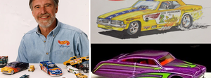
Meet Larry Wood: The man whose designs launched a million hot rod dreams
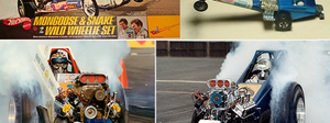
Can you imagine a toymaker designing your Top Fueler? 'Snake' and 'Mongoose' could
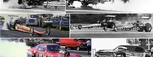
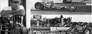
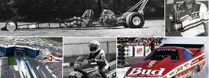
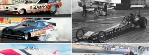
For the love of old drag racing photos
-
The ultimate Funny Car winners quiz
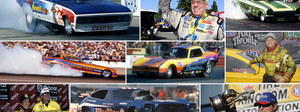
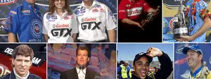
Still popular after all these years: Catching up with fan favorites Eddie and Ercie Hill
Eddie Hill, the early years
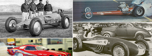
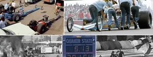
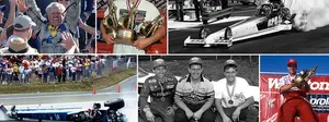
55 years ago, Don Garlits forever changed the look, feel, and future of Top Fuel racing
On a roll: A look at some all-time great NHRA Drag Racing success streaks
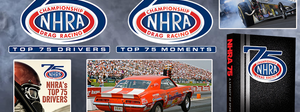
NHRA's Top 75 Moments: Bernstein, 'Big,' and Shirley reflect on making history
Funny Car set to turn 1,000: A look back at the milestone races along the way
Beyond the Top 75s ...
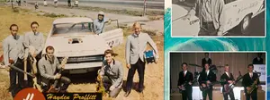
Wait ... Jim Head was in a 1960s surf band promoted by a drag racing legend? Yep.
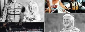
More Martin memories
- ad
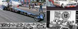
The Popular Hot Rodding Championships put U.S. 131 in the national spotlight
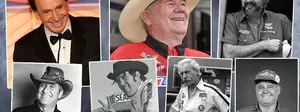
Friends we lost in 2025
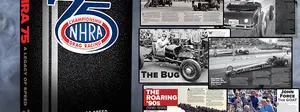
Re-telling NHRA history: The 75th anniversary book and other special projects
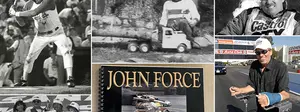
It was John Force's world, and we were all thrilled to be living in it
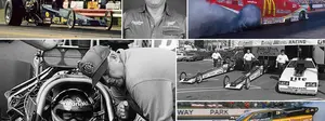
The Joyce of Drag Racing Photography
Two legends: 'Big' and Bakersfield
When did we start doing that? Tracking some of the biggest changes in our sport
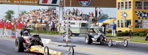
From 10-time dominators to one-time winners, a history of Indy Top Fuel champs
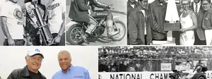
Legend to legend: Don Prudhomme on Don Garlits, Indy, and other great takes
NHRA Rookies of the Year: A look back at where some fabulous careers began
- ad
NHRA national event history: A look at the tracks and stories that drove the sport
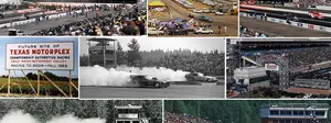
The Northwest Nationals has historically put the 'great' in Great Northwest
Larry Minor was a major player
How the early 1980s shaped NHRA's future
A Memorial Day salute to armed services sponsorships in NHRA history
Ghost-track hunting goes high tech
 |
 |
Okay, ghost-track fans – and that seems to be just about every one of you based on the e-mails (more than 60) I've received and all of the comments last weekend in Bakersfield (about a dozen) – it's time to get serious about this endeavor. If we're going to keep at this, I'm going to go a little high tech on you, but not so much that average users can't follow along. Believe me, this is worth the time.
First things first: If you don't already have it downloaded to your computer, go get Google Earth; here's the link. It's a pretty small download for such an amazingly great program. Download it and install it. Don't be afraid. (Technology: good; stick in the dirt: bad.) Go ahead … we'll wait for you.
(Everyone sing: "It's a small world after all …")
Okay, good. The great thing about Google Earth that will beat the heck out of any static satellite images I have posted here is that once I get you to the starting line, you can interact with the map --zoom out, move the map around, and so forth -- to get a better big-picture idea where the image/track is located.
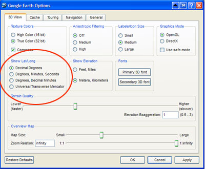
Okay, so I hope you have Google Earth loaded. One more thing now; we gotta go under the hood. Not a major overhaul, just a small tune-up. My top-secret ghost-track source (second only to the CIA in terms of secrecy) is the TerraTracks Global Authority, a small team that has been hunting ghost tracks for years. Because the TTGA uses decimal degrees to pinpoint locations, we have to reconfigure Google Earth to DD. To do this, click on the Tools menu at the top of the screen and select Options, then in the little box that says, Show Lat/Long, click the selection Decimal Degrees. Click Apply, and we're ready to rock.
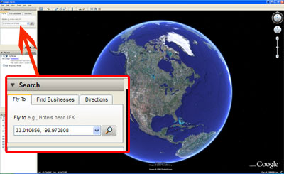
When you launch Google Earth, you're in outer space, looking down on planet Earth. In the top left corner of the screen, you'll see a Fly To dialog box. Just copy and paste the DD numbers I give you (which will look like this: 37.508573, -122.495722) into the Fly To box and hit Enter on your keyboard (or click the little magnifying glass; your choice. See how easy I am?).
(Also, for technorati among you, obviously you can enter these same numbers into a portable GPS to guide you to these hallowed sites.)
Okay, and away we go …

 |
 |
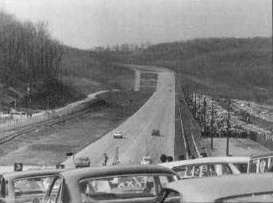
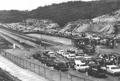
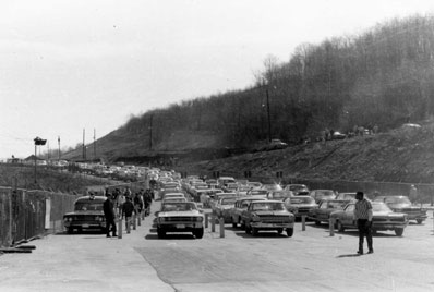
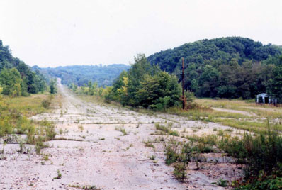
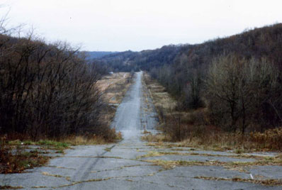
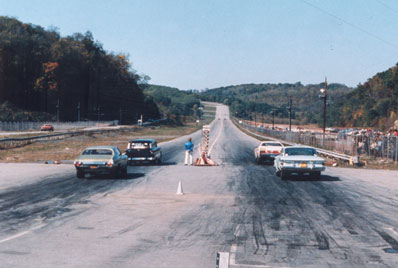
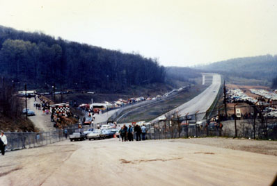
For whatever reason, no track got more ghost-track requests than Pittsburgh Int'l Dragway, a popular little place just outside of Cuddy, Pa. The track was opened in 1962 by Ed Witzberger, who used to run the half-mile Heidelberg Raceway dirt circle track. He'd run drags on the front stretch, and cars would line up for hundreds of yards, and he finally decided they needed to have their own asphalt racetrack, which was opened on the old
Things went swimmingly for 14 years, and the track was frequented by all manner of big hitters, including "Big Daddy" Don Garlits, Shirley Muldowney, Bill "Grumpy" Jenkins, and "Jungle Jim" Liberman, until an ownership group that also owned Atco Dragway in New Jersey bought it, and, apparently, a lack of communication between owners and management contributed to its fall, and the track closed in 1976.
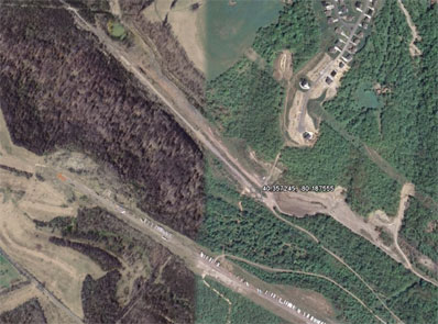
To find the former site of Pittsburgh Int'l Dragway, enter these numbers in your Google Earth Fly To box: 40.357245, -80.187555. That will put you right on the starting line; the track ran northwest (to the upper right). You can also log on to this Web site, which has some photos of the old track but not a lot of background.
Tim Froment wrote, "Growing up, I lived only 15 or 20 minutes from the track. It was located outside of a small city south of the 'burgh called Bridgeville, Pa., off State Route 50 and Route 978 in the little hamlet called Cuddy, Pa. PID actually started out as an airstrip. Then sometime around 1962 or so, the airstrip was converted over to the dragstrip. A new airfield was built on a ridge just above the dragway [seen just below the dragstrip in this pic]. As a kid in high school, I was one of a few of my buddies that enjoyed going to the track. It closed the year I graduated, unfortunately.
"I don't remember too much about the history of the place but was digging around after reading your column on the ghost tracks and found out something I never knew. Something that ties PID to my family. The original single runway airstrip down in the valley, called
According to Jerry "G-Man" Gross, who sent along the photos below (taken by track photographer Bill Truby), the track opened May 10, 1964, and was sanctioned by NHRA on June 28 of that year and closed in May 1976. I also heard from Truby himself, who confirmed all of the above and even noted that because the original airport was built in a valley, the wind would play havoc on the planes, sometimes flipping them, so they decided to use it for a dragstrip. "It started as an NHRA track then switched to NASCAR when Ed and Wally [Parks] couldn't agree on things. Later in the '70s, it returned to the NHRA fold. Many of the top Sportsman drivers got their starts here, including Jim Boburka, Harry Luzader, Tom Myl, and Mike Kosky. The track hosted a WCS meet in 1973. The basic track is still there, just all overgrown, and all the structures have fallen down. Each year, we have a reunion at a local hall that attracts over 350 people."
 |
 |
|
|
|
 |
 |
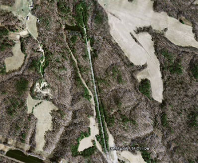
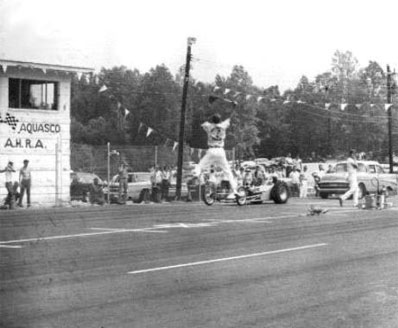
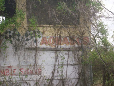
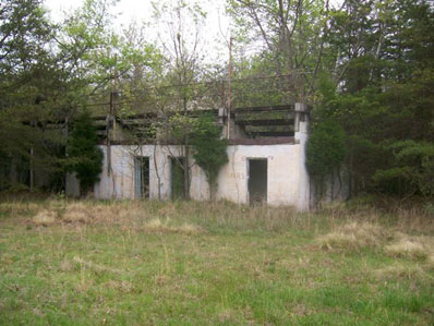
Lee Martin, who earlier shared with us a great photo of Roanoke Raceway in
"It's sat vacant for 30 years, but is all still there," he said. Andy Marquis snagged the two bottom photos below; you can see them and more here.
The Aquasco starting line is at 38.554005, -76.711128.
 |
 |
 |
 |
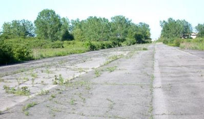
New York National Speedway, in Center Moriches on
Unfortunately, NYNS is best remembered for hosting the flop that was the 1974 PRO Challenge. After producing two moderately successful National Challenge events in 1972 and 1973 in Tulsa, Okla., the race went to the Empire State but suffered from poor attendance (reportedly due to lack of advertising), rain Saturday that washed out the night qualifying sessions, and low car counts (21 Funny Cars and 23 Pro Stockers for what were billed as 32-car fields). You can read a full recap of the disaster here: http://www.northernthunder.com/prodoa.html.
From what I can find, the track was open from 1966 through 1977. I found the location (40.835, -72.79083), but, as you can see from the two pics below, what used to be ain't no more.
 |
 |
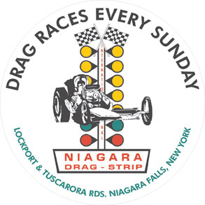 |
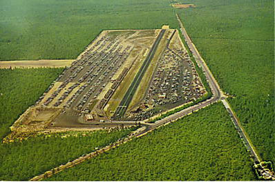
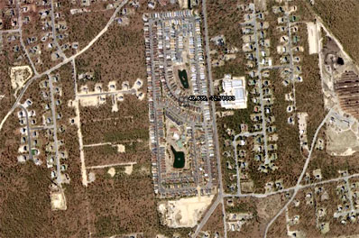
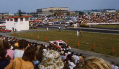
Niagara Dragstrip (also known as
Located at
It became famous with locals for its radio spots containing the drawn-out words "Sundaaaayyyyy Niagara," which is now the name of a popular Web site/message board devoted to the racers, fans, and officials who frequented it.
Reader Brad sent me the pic below left of the starting line, and I found this recent photo of the track on another Web site.
 |
 |
|
 |
||
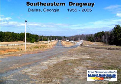 |
David Moore asked about a more recent closing, that of longtime NHRA member track Southeastern Int'l Dragway, just outside of
Orginally opened by Marvin "Red" Jones as Red's Dragstrip, the track was 1,000 feet long and constructed of tar and gravel. The track was what became the return road; it was moved to lengthen it to a full quarter-mile later in the 1950s and drew the likes of Garlits, Don Nicholson, and Arnie Beswick.
In the 1970s, the racing distance was shortened to eighth-mile, but it still drew a lot of the region's top bracket stars. You can find it here: 33.950812, -84.765759. The Google Earth image is kinda weird on this one; the track looks like it's on some sort of seam between two satellite images but with different exposures. You can find out more about the track on the Georgia Drag Racing Web site.
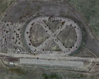 |
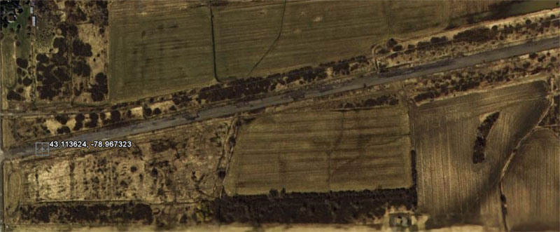
Ric Grassmick fondly remembers going to the AHRA Springnationals in 1973 at Century 21 Raceway east of
"I remember climbing up the oval track to the dragstrip guardrail about 200 feet downtrack during Top Fuel qualifying. As I readied my Instamatic for a pic over the guardrail as the Tree counted down, I felt a hot blast in my face. The fueler in the lane nearest to me launched and immediately headed toward the guardrail, unbeknownst to me. As I recovered my composure and looked downtrack, I saw the black tracks came to within a foot of the rail I had been leaning over! The driver never lifted. I just got a blank pic of the starting line. My buddies sitting in the stands across from me said it was the coolest thing they had ever seen. Guess I'm lucky to still be here."
As you can see from the Google Earth image (39.745597, -104.732093), the dragstrip was next to a combination third-mile-oval/figure 8 track. The track operated only from 1971 through 1973. More info can be found here.
 |
After seeing the pics last week from
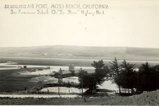
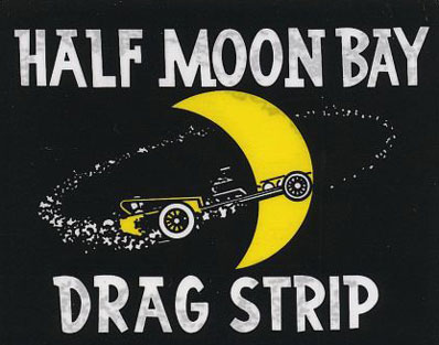
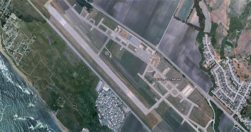
In the late 1950s, San Francisco Bay Area hot rodding clubs like the Lightning Rods from San Bruno and the Piston Pushers from South San Francisco had long raced on the straightaway of the Upper Great Highway near San Francisco’s Ocean Beach before the government agreed to allow them to compete on the 3,000-foot-long, 60-foot-wide asphalt landing strip at the small, isolated coastal airport named Half Moon Bay Airport, about 20 miles south of San Francisco.
As more and more clubs wanted to join the fun, the city demanded that improvements be made to the strip and insurance be taken out for safety purposes, but none of the clubs had the money to make those improvements. In 1957, the city put it up for rent, and McLennan, who also owned the Champion Speed Shop on Mission Road in Colma, stepped up and officially opened Half Moon Bay Drag Strip. The timing tower was on top of a bread truck, and surplus military telephones were used to signal from one end of the track to the other. The track was a big part of any East Coast racer's West Coast itinerary, and all of the big guns ran there before the track closed around 1968.
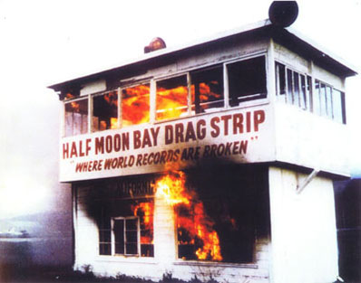
The younger McClennan also sent this photo of the ceremonial torching of the
 |
 |
|
|
|
This and that: Speaking of things on fire, our own
Brad's dad, Mert, was match racing against one of Joe Pisano's entries (he guesses it was 1981), and he had a major clutch explosion that broke three of four framerails.
"Well, the track had quite a bit of growth from weeds and such that they didn't take care of, so these sparks and hot clutch parts ignited all the dry growth in both lanes," he was told. "It took a while to put out, but they got the races going again after that. That and other incidents led some of his nitro racing friends to refer to him as 'Sparky,' a moniker that stuck for a while but vanquished over time."
Craig Sanburn wrote, "I drove by the old spot where
"For those wanting to go see the remnants, the fence and gate are still there, and the road that went to the glider field is now just dirt next to the small drainage canal. But look for the asphalt; that’s the staging lanes and the power pole, and you’ll find yourself standing pretty much where the starting line was for so many years.
 |
My source at the TTGA also said that I missed the actual location of Dallas Int'l Motor Speedway by a few thousand feet (I had dead-reckoned it off an old USGS map; the actual location of DIMS would be 33.011548, -96.974946 (starting line), 33.010656, -96.970808 (finish line), 33.008730, -96.961090 (end of asphalt).
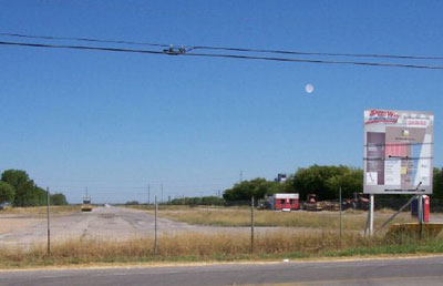
"The starting line is now directly -- literally 10 feet -- in front of a car dealership," he said. "I've included a shot taken from my rental car as I performed a full-throttle launch there aimed down the track a while back, drawing many confused looks from salesmen and customers. Note handheld GPS on the dash in lower left corner."
Dave Wallace forwarded one of my reader's questions about Lakeland Motorsport Park in Florida, which the reader believed had been built by Don Garlits as a test track, to "Big Daddy" himself, who responded, "I only rented
 |
Lots of people still sharing memories of
My old pal and former NHRA co-worker Jim Skelly (now a council relations director at SEMA) passed along a link to a wide-ranging message board where people get together and share their memories of long-lost tracks. Check it out here.
Kenneth Skloss also sent me the photo at right from Alamo Dragway, which we covered earlier. You can still see the dragstrip, right behind the sign near the fence proclaiming it as
Okay, I literally could go on and on because I've only waded through about two-thirds of the requests I've received. I'll try to get to the others in the future, but it can be quite time-itensive hunting down some of this stuff, and if I continue to spend days doing this, work on my "other" job -- that pesky little weekly publication we call National DRAGSTER -- will suffer, and I wouldn't have, well, a ghost of chance of meeting my deadlines.
I hope you've enjoyed huting today's hauntings with me. See ya next week.